
Mapping & geospatial
Accurate, usable spatial data for planning, design and land management: from orthophotos to online GIS platforms.
A good map is a decision made sooner.
Geospatial data is only worth something when it is accurate, current and easy to use. So we do not just hand over files: we build databases, analyses and visualisations that non-GIS specialists can use too.
Our work supports urban planning, environmental management, cadastre and infrastructure projects, from first property registration to road updates in Tirana.
From image to decision
Orthophoto & photogrammetry
Geometrically corrected aerial imagery and terrain models for design.
- High-resolution orthophotos
- DTM / DSM models
- Point clouds and 3D meshes
GIS & spatial analysis
- Geospatial databases
- Analysis for urban planning and environment
- Interactive visualisation for decision-making
Digital cartography
- Thematic maps: transport, energy, tourism, environment
- 2D and 3D models for presentation
- Publishing to online platforms
From the first question to delivery
Sources
What already exists (cadastre, maps, imagery) and what must be newly surveyed.
Capture
Drone flights, field measurements and digitising.
Data model
Layers, attributes and rules, so the database stays clean over time.
Publishing
Maps, reports or an online platform, depending on who will use it.
Where we have done it
Technical Assistance for the Preparation of Projects for Energy-Efficient Schools in Albania
Decagon shpk was contracted by ALBEGIS&CO to carry out topographic surveys for twenty educational buildings. The survey consisted of the…
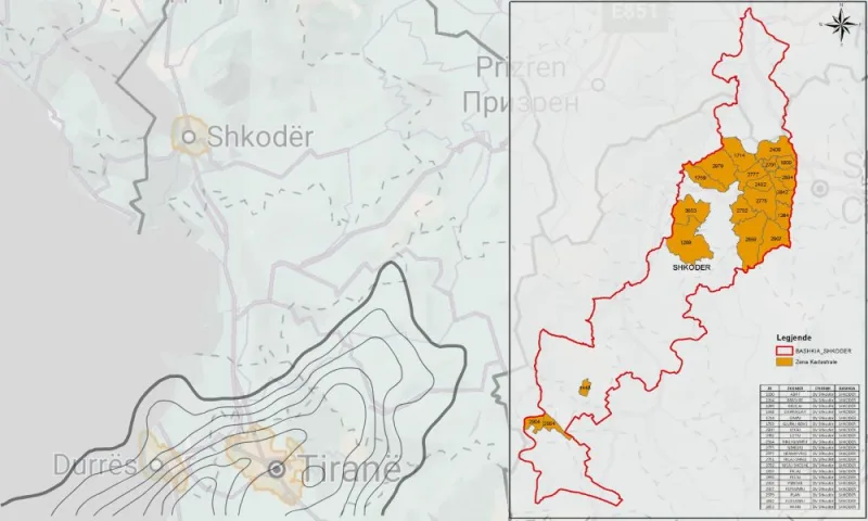
Initial Property Registration for the Municipality of Shkodër
The initial registration of immovable property consists of recording every immovable property, whether state-owned, public or private, in the cadastral…
Topographic and Cadastral Surveys for the One Albania Stations
The company One Albania, active in the field of telecommunications, has an extensive network of stations (antennas, poles, masts, etc.)…

Product Development Implementation – Package 2 (Outdoor & Museums)
As part of the PIUTD package, which aims to boost tourism in Albania, two projects with a particular impact on…
Topographic and Cadastral Surveys for the IMI Quarries
The company ILLYRIA MINERALS INDUSTRY (IMI), active in the field of mineral extraction, carried out the initial surveys of the…
Development of an Applied Regional Development Model in Cooperation with UBT
As part of the project Establishment of an Applied Regional Development Model in partnership with UBT, Decagon shpk was contracted…
Further reading
Technical notes from our work.

Coordinate systems in Albania: KRGJSH, UTM and the Gauss-Krüger legacy
Most errors in deliverables come not from measurement but from the wrong projection. Which system is used when, and how…

From drone photos to a 3D model: photogrammetry in everyday work
A half-hour flight can replace days of measurements. How photogrammetry works, where it is accurate and where ground control points…
Frequently asked questions
Which formats do you deliver?
Whatever your team uses: vector layers (e.g. Shapefile, GeoPackage, DXF), rasters (GeoTIFF) and point clouds (LAS/LAZ). We agree this at the start.
Can we view the data without GIS software?
Yes. We publish them to an online map that opens in the browser, with the layers and information you need.
Have a project in mind?
Tell us where the site is and what needs to end up on screen. We reply within one working day.