
Initial Property Registration for the Municipality of Shkodër
- Client
- State Cadastre Agency
- Period
- June, 2025 → Ongoing
- Location
- Shkodër, Albania
What we did
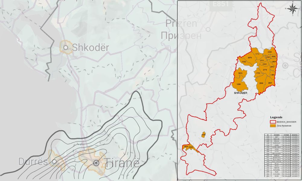
The initial registration of immovable property consists of recording every immovable property, whether state-owned, public or private, in the cadastral zone on the respective property card and the cadastral map. This process takes place in two phases, the first of which includes the public information process.
In this phase, cooperation between the population and the verification/measurement teams in the field is important in order to clarify the boundaries of the immovable properties. The actual measurements and the documentation collected are processed in the office to create the cadastral map and to record the data of the immovable properties on the card.
Project data
- Client
- State Cadastre Agency
- Partner
- SRP Albanian Engineering, MCE
- Location
- Shkodër, Albania
- Start
- June, 2025
- End
- Ongoing
- Services
- Engineering Studies, Topographic Surveys
Related projects
Technical Assistance for the Preparation of Projects for Energy-Efficient Schools in Albania
Decagon shpk was contracted by ALBEGIS&CO to carry out topographic surveys for twenty educational buildings. The survey consisted of the…
Topographic and Cadastral Surveys for the One Albania Stations
The company One Albania, active in the field of telecommunications, has an extensive network of stations (antennas, poles, masts, etc.)…

Product Development Implementation – Package 2 (Outdoor & Museums)
As part of the PIUTD package, which aims to boost tourism in Albania, two projects with a particular impact on…
Have a similar project?
Tell us where it is and what you need. We reply within one working day.