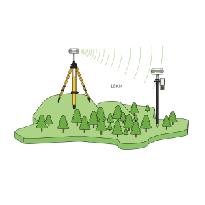
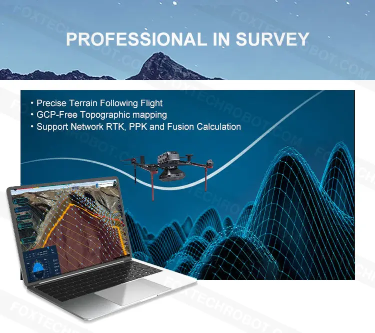
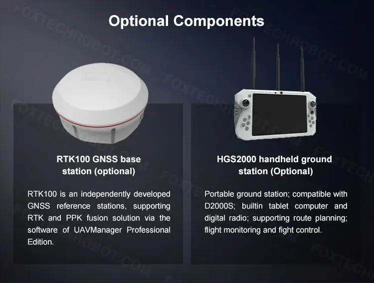
D2000S is equipped with a high-precision differential GNSS board and two dual-differential antennas. Through the optional physical base station with RTK and PPK fusion solution, it can support high-precision POS assist. ed aerial triangulation and realize image control-free applications.
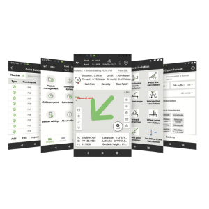
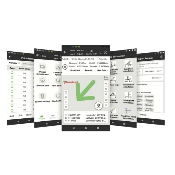
Also, with the software named UAV Manager Professional Edition, it has various route modes for different application requirements. The software supports accurate three-dimensional route planning, three-dimensional real-time flight monitoring, GNSS fusion solution, control point measurement, aerial triangulation, one-key to output and browses multiple data results such as TDOM, DOM, DEM, DSM, LIDAR point cloud, and so on.
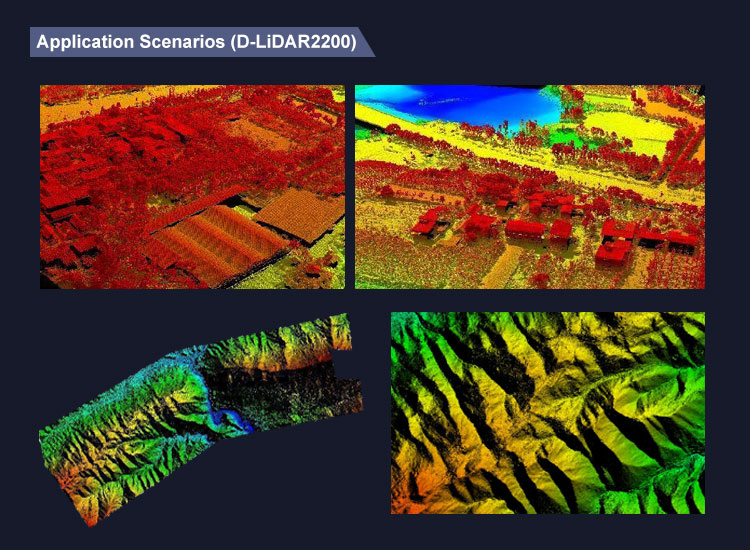
Image control-free topographic mapping
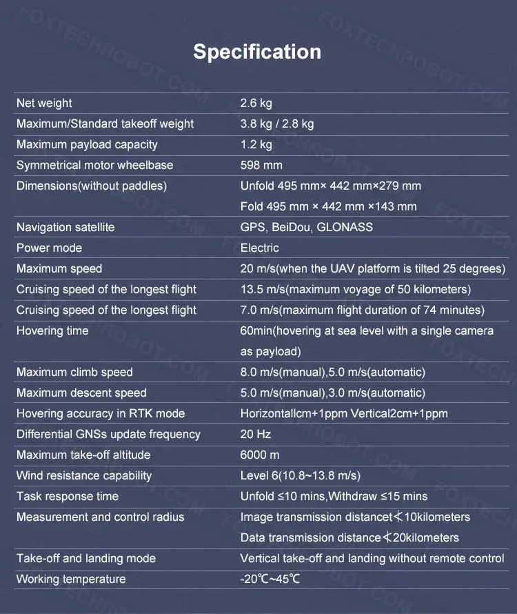
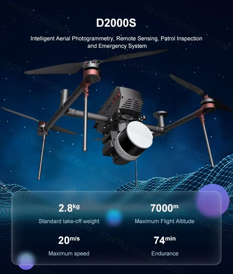
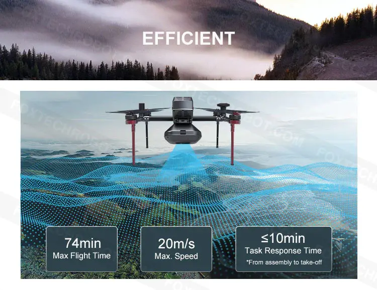
Long endurance, high efficiency, and high reliability
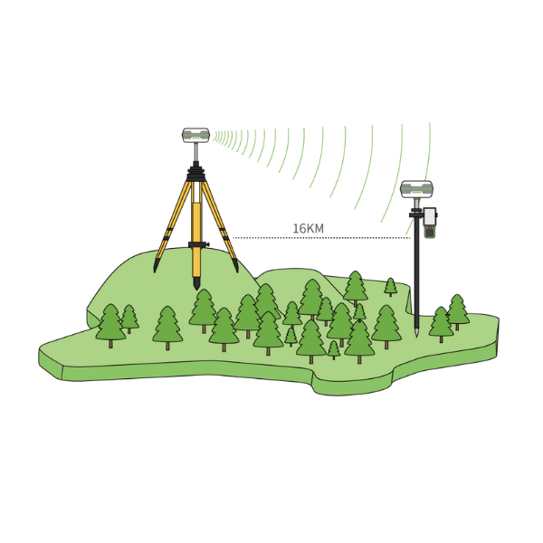
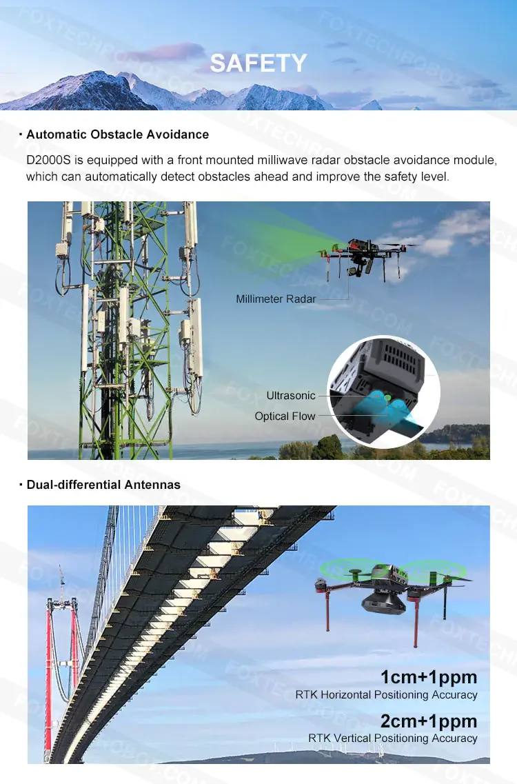
Dual-differential antenna
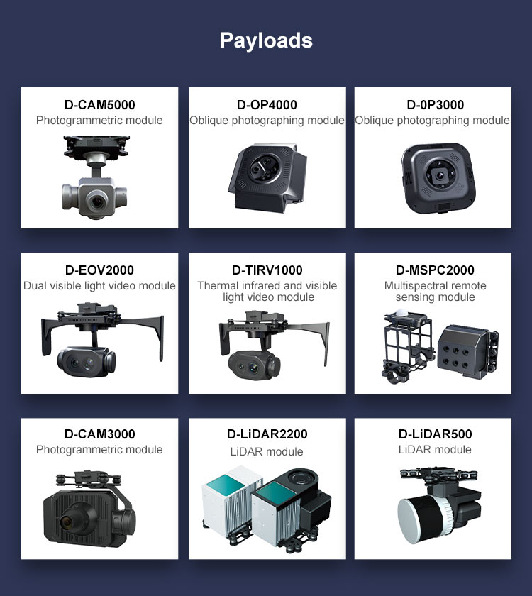
Module payload design and multi-source data acquisition
Precise terrain following flight.
Automatic obstacle avoidance
One-stop software solution and advanced data processing workstation
Hello there! I hope you’re doing well today. I’m excited to share with you some incredible products that have been flying off our shelves lately! In addition to the wonderful items you’ve already been browsing, may I suggest taking a peek at our bestselling products?
_04(1).jpg-t)
 s
s